National Geographics makes a nice waterproof map that covers the whole course. It is only $11.95 at Amazon.
Black Hills North [Black Hills National Forest] (National Geographic Trails Illustrated Map). These maps are based on it
BH100 north (pdf) BH100 north (jpg) BH100 south (pdf) BH100 south (jpg)
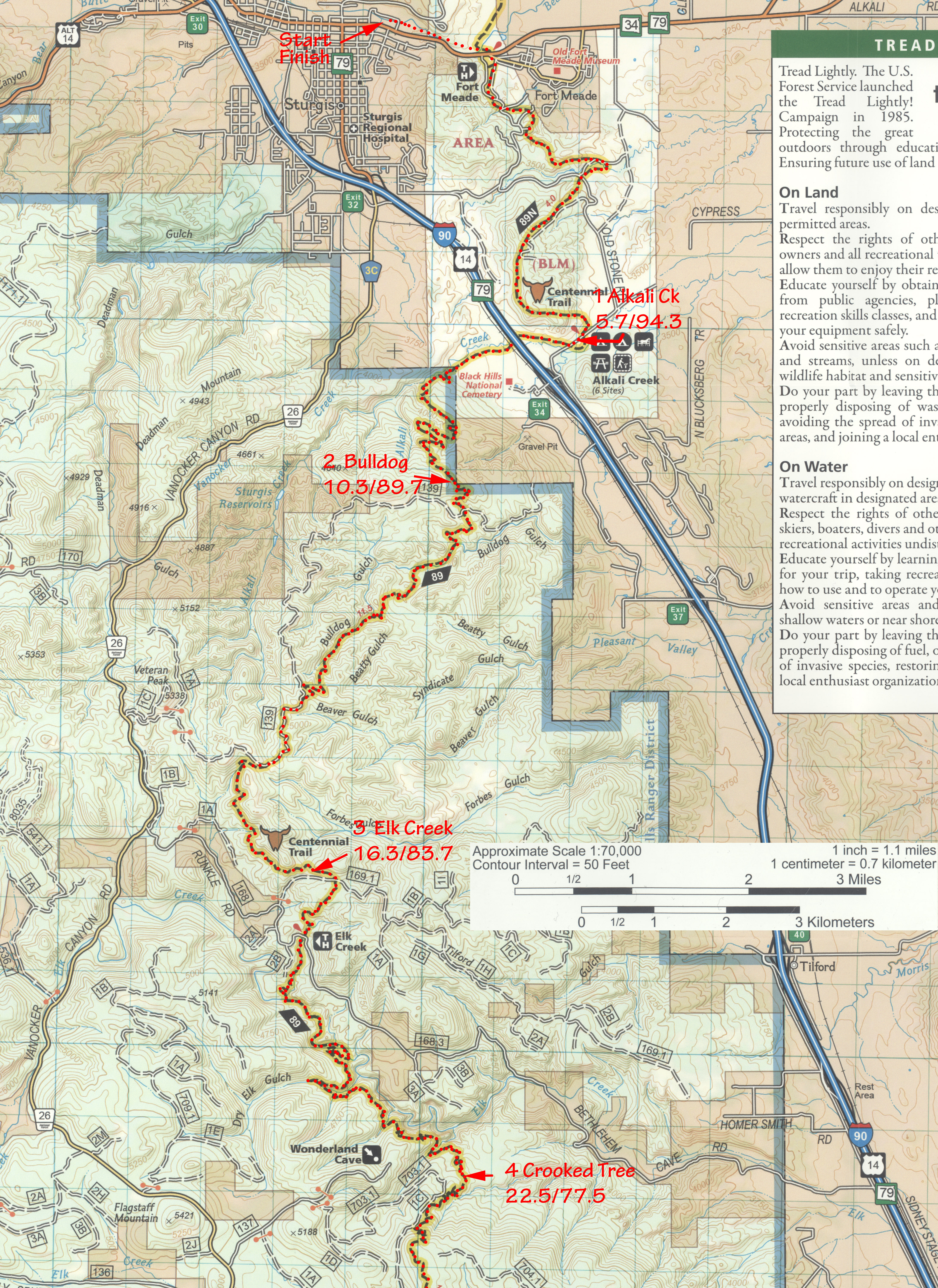
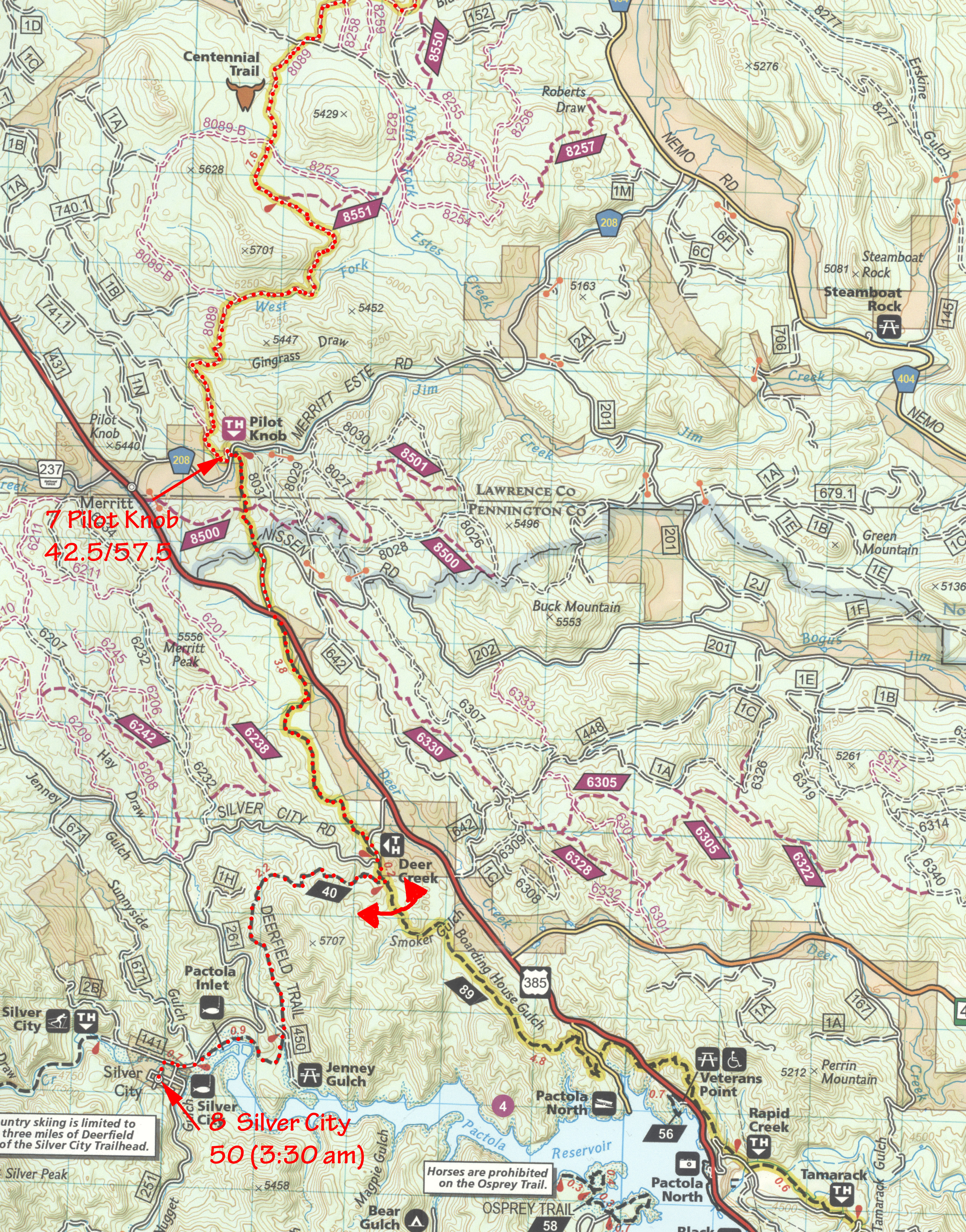
I found a Centennial Trail trace on the GPSies site and modified it in Mapsource (Garmin) to include the entire course plus aid stations. It is broken into 500 point tracks as many GPS receivers will only upload tracks of 500 points of less. They'll upload many different tracks though.
BH100 course gdb format BH100 course gpx format
BH100 course as one long track in gdb or gpx formats
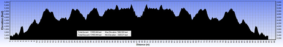
I carried a Garmin eTrex Vista during the 2016 run collecting data every 20 seconds.
Black Hills 100 2016 actual course gdb format gpx format
Note the measured vertical climb is >17,000 feet.
Here are the USGS Topographical Maps that cover the BH100 Course. They are in Geo-Tiff format but can be opened in any photo editing program. To use these in mapping software the corresponding *.tfw files are also needed and are included below. The tiff files are 7 MB so take a few seconds to download.
Deadman Mtn, SD o44103c5 tiff tfw
Fort Meade, SD o44103d4 tiff tfw
Nemo, SD o44103b5 tiff tfw
Piedmont,SD o44103b4 tiff tfw
Silver City,SDo44103a5 tiff tfw
Sturgis,SD o44103d5 tiff tfw
Tilford,SD o44103c4 tiff tfw